Course photo
Course photoCourse photoCourse photoCourse photo

Moderate difficulty

Show layout maps
Good conditions
22 days ago

About the course

Information panel on car park
9 holes
Concrete, Dirt, Asphalt Tees
Latitude 64 Elite Targets
Mixed use
Public park
Dogs allowed
Not cart friendly
No drinking water available
No restroom available
Not stroller friendly

Not recommended for individuals with limited mobility

Established in 2023

Time your trip

Course traffic - Players usually spend 1 hour here.

Want access to real-time course traffic?It's on UDisc Pro.

Reviews

Show all
Upkeep
3.0
Shot variety/design
3.7
Tee areas
2.2
Signage/wayfinding
1.4
Amenities
0.6
Scenery/views
4.8
konna77

@konna77

80

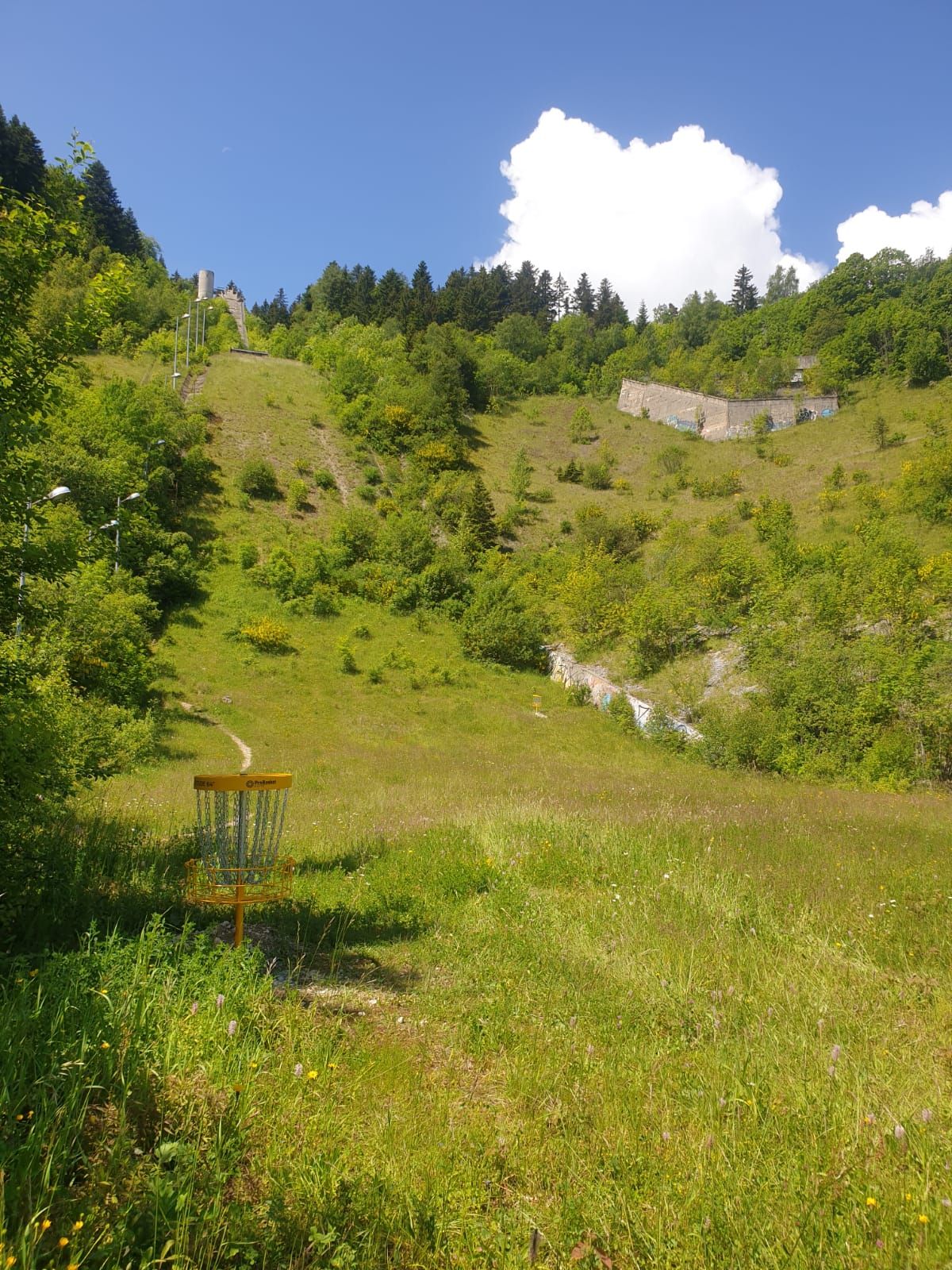
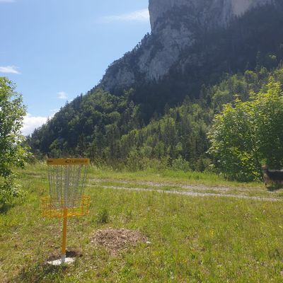
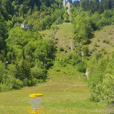
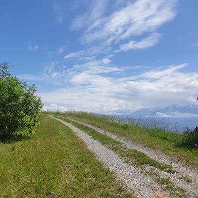
Suomen mittakaavassa surkea rata. Kotimaassa tämä rata saisi faciliteeteiltaan 0.5* mutta paikallisessa kulttuurissa on annettava hitunen ylöspäin. Radalla teepaikat ovat täpliä maassa tai puutikkuja. Ob merkkejä ei näkynyt vaikka kartan mukaan ob alueita olisi pitänyt olla. Väylät vahvasti vesakoituneet tai pusikoituneet ja osa väylistä heitettiin sakean kasvillisuuden seassa. Siirtymät paikoin heikkoluntoisia polkuja ylös alasm Väyläopasteita ei ollut mutta alussa väyläkartas kuva ja sillä pärjäsi hyvin. Miljöö ja maisemat kuitenkin mielettömät. Grenoblen laaksokaupungista 11km serpentiinitietä vuoren huipullle v 1968 talviolympialaistel mäkihyppy keskittymään. Paikassa läsnä vahvasti historian havinaa rappeutuneiden mäkihyppytornin ja katsomoiden katveessa. Taustalla olevia Alppeja ihailee jokaisella heitolla. Ei sovellu aloittelijoille, mutta fribaniiloille ehdottomasti suositus!!

danielkonecny

@danielkonecny

89

Very interesting course, gorgeous views over the city, and vibes of abandoned area - ski jumping complex from 1968 Olympics. Holes have some nice variety and elevation change as expected at such place. Difficulty just enough to challenge even an advanced player, beginners can go with the shorter tees. Maintenance of the course is not very good, grass and bushes would use a lot of trimming, but it is not that bad that discs could get easily lost. I would say that it is worth visiting even just for the vibes and scenery.

1

Upcoming events

Show all
No upcoming events!

Leaderboard

Main layout over the last 30 days

Show all
1.
2.
3.
4.
5.

Nearby courses

Nearby stores

Frequently asked questions

How do I get to Parcours du Tremplin Olympique?
You can get directions to Parcours du Tremplin Olympique by clicking Get Directions, which will open your device's map application with the disc golf course location. The disc golf course is located at 45.16570670901686, 5.632915184941027 in Saint-Nizier-du-Moucherotte, France.
Do I need to pay to play disc golf at Parcours du Tremplin Olympique?
Parcours du Tremplin Olympique is free to play! Just show up and enjoy the disc golf course.
What is the difficulty and length of Parcours du Tremplin Olympique?
Parcours du Tremplin Olympique has 9 disc golf holes and has a difficulty rating of "Moderate".
How highly rated is Parcours du Tremplin Olympique by the disc golf community?
Parcours du Tremplin Olympique has an average rating of 3.5 out of 5 stars based on 21 community reviews.
What amenities are available at Parcours du Tremplin Olympique?
Parcours du Tremplin Olympique offers the following amenities: 9 disc golf holes, pet-friendly areas.
When is the best time to play at Parcours du Tremplin Olympique?
Upgrade to UDisc Pro to see detailed course traffic patterns and find the best times to play disc golf here.
How can I track my disc golf round at Parcours du Tremplin Olympique?
You can track your disc golf round using the UDisc mobile app. If on your phone, click the "Start a Round" button at the bottom of this page to begin navigating Parcours du Tremplin Olympique and tracking your disc golf round. The app provides GPS-enabled disc golf hole maps, scorekeeping, and stats tracking. Upgrade to UDisc Pro for advanced features like detailed statistics and course traffic information.